Maps and satellite imagery look accurate at first glance but if you’re measuring distances, planning a site layout, or comparing features across different images, the scale factor is what tells you how much the image has been stretched, shrunk, or distorted relative to real-world ground measurements. It’s not just about “zoom level.” It’s about knowing whether 1 centimeter on your screen equals 10 meters, 100 meters, or something else entirely and why that number changes depending on where you are, what projection is used, and how the image was processed.
What does “scale factor” mean for maps and satellite imagery?
A scale factor is a ratio: the distance on the map or image divided by the true distance on the ground. A scale factor of 1.0 means no distortion what you see matches reality exactly. But most digital maps and satellite views use projections (like Web Mercator) or orthorectification methods that introduce small but meaningful variations. For example, near the equator, a satellite image might have a scale factor close to 1.002, while near the poles or at high elevations, it could be 1.015 or more. That difference matters if you’re calculating fence lengths, crop areas, or road widths.
When do you actually need to use scale factor not just zoom or legend scale?
You need to use scale factor when precision matters beyond visual estimation. This includes:
- Measuring land parcels from satellite imagery in GIS software
- Overlaying drone-captured orthomosaics with existing CAD drawings
- Converting pixel-based measurements (e.g., from a screenshot) into real-world units
- Validating accuracy claims made by mapping platforms or survey reports
Zoom level alone won’t help here two images at the same zoom can have different scale factors due to terrain elevation, sensor angle, or projection choice. The legend scale (e.g., “1:5,000”) is only valid at one reference point or line; scale factor gives you the actual multiplier at your specific location.
How do you find or calculate scale factor for a given map or image?
Many platforms don’t show scale factor directly. Here’s how to get it:
- Check metadata: Satellite providers like Maxar or Sentinel often include ground sample distance (GSD) and projection info. GSD (e.g., 0.5 m/pixel) is a type of local scale factor just convert units consistently.
- Use known distances: Measure a real-world feature you can verify (e.g., a standard soccer field is 105 m long). If it measures 210 pixels in your image, the scale factor is 105 m ÷ 210 px = 0.5 m/px.
- GIS tools: In QGIS or ArcGIS, enable on-the-fly projection and check the “map scale” indicator it updates dynamically as you pan. Some plugins report local scale factor based on current CRS and location.
Don’t assume scale factor is uniform across the whole image even within a single satellite scene, it can vary by up to 0.3% between corners due to terrain relief and viewing geometry.
What common mistakes trip people up?
One frequent error is treating map scale and image scale as interchangeable. A printed map labeled “1:24,000” assumes flat ground and a specific projection. A satellite image viewed online may be reprojected on-the-fly, changing its effective scale factor without warning. Another mistake is using scale factor from one part of an image (e.g., the center) to measure features far away especially near mountains or coastlines, where elevation differences distort ground distance representation.
Also, confusing scale factor with resolution: a 30 cm GSD image isn’t automatically “more accurate” than a 50 cm one if its scale factor hasn’t been corrected for tilt or terrain. Resolution tells you detail level; scale factor tells you measurement fidelity.
What’s a practical next step if you’re working with this right now?
Pick one recent map or satellite image you’ve used for measurement. Open it in a tool that supports georeferencing (even free ones like QGIS or Google Earth Pro). Find a known real-world length like a building facade, runway, or road segment and measure it both on-screen and in reality. Divide real length by on-screen length to get your observed scale factor at that spot. Compare it to the stated scale or GSD. If they differ by more than 1%, note where and consider whether elevation correction or a different base layer would improve your work.
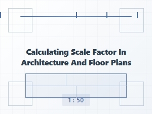
If you're helping students understand this concept through hands-on examples, try these real-world scale factor problems for middle school students. For engineering teams validating site layouts, the scale factor application in engineering and manufacturing section shows how small discrepancies affect tolerances. And if you’re cross-referencing satellite views with floor plans, the calculating scale factor in architecture and floor plans guide walks through aligning digital models with aerial data.
For deeper technical background on coordinate systems and projection math, the PROJ library documentation explains how scale factor is derived and applied in open-source geospatial tools.
Quick checklist before measuring:
- Confirm the image is orthorectified (not just a raw photo)
- Identify the coordinate reference system (CRS) and projection used
- Check whether elevation data was included in processing
- Measure at least two known distances in different parts of the image
- Record the scale factor you calculate not just the zoom or legend scale
 Practical Problems of Scale Factor in Architectural Drawings
 Comparing Planetary Distances with a Scale Factor
 Applying Scale Factor in Engineering and Manufacturing Problems
 Identifying the Scale Factor Worksheet
 Mastering Scale Factor Identification Worksheet Answers
 Mastering the Scale Factor with Geometry Practice Sheets